
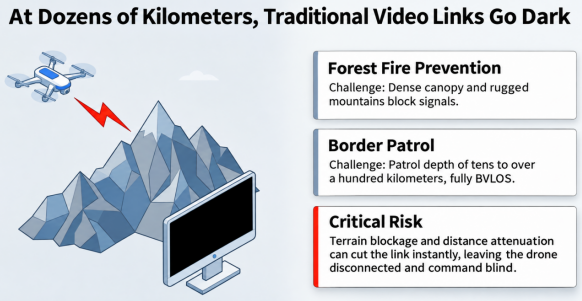
For forest fire prevention and suppression patrols, emergency geological surveys in remote mountain areas, and long-range border monitoring, industrial-grade heavy-payload drones have become essential aerial assets. But as missions extend tens of kilometers—and potentially more than 100 kilometers—beyond visual line of sight (BVLOS), maintaining reliable HD video transmission and real-time flight-control data links becomes increasingly challenging.
In mountainous terrain, conventional point-to-point links can fail abruptly because of terrain obstruction, signal attenuation over distance, or antenna misalignment. The result can be a loss of contact with the drone and a critical loss of live imagery at the command center.
How can operators maintain a long-range, high-bandwidth, low-latency HD video link across complex terrain without compromising airborne payload efficiency?
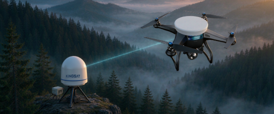
Drawing on its experience in wireless microwave communications and stabilized servo tracking for maritime and land-based applications, KINGSAT has developed a 1.4 GHz/microwave BVLOS auto-tracking video transmission solution for heavy-payload drones used in forest monitoring and border security. By coordinating a lightweight airborne tracking terminal with a stabilized ground tracking station, the system is designed to maintain an air-to-ground HD wireless link over distances ranging from tens of kilometers to more than 100 kilometers, depending on deployment conditions.
1. Challenges: Two Key Obstacles to BVLOS Communications
Dense forest cover and highly variable border terrain expose two fundamental limitations of conventional drone video links.
1.1 The Trade-Off Between Omnidirectional Coverage and Antenna Gain
Limitations of omnidirectional antennas. Many conventional drones use low-gain omnidirectional whip antennas, typically around 2 dBi. Increasing transmit power at the ground station alone cannot fully overcome range limitations and may introduce additional interference.
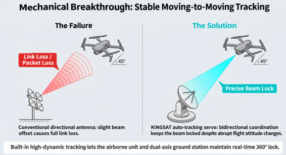
Directional antenna tracking. A directional antenna provides higher gain, but a drone continually changes its attitude as it climbs, banks, dives, and circles. A fixed directional antenna cannot reliably keep its beam aligned; an angular error of only a few degrees can cause the link to lose lock.
1.2 Strict Payload and Power Constraints
Even on heavy-payload drone platforms, available payload capacity and mounting space are valuable. Communications equipment must be compact, lightweight, and power-efficient to minimize aerodynamic drag and avoid interference with the aircraft’s onboard electronics.
2. Solution: Moving-to-Moving Tracking and Long-Range Video Links
KINGSAT addresses these requirements with an integrated moving-to-moving video transmission system comprising a lightweight airborne tracking terminal (U Series), stabilized ground or vehicle-mounted antennas (ML/M Series), and high-power wireless mesh networking modules.
2.1 System Architecture and Data Flow
The solution connects three closely coordinated elements:
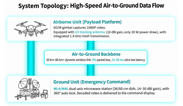
Airborne segment — heavy-payload inspection drone
Video and thermal imaging capture. An HD gimbal camera or dual-sensor visible-light/infrared payload captures live 1080p video and thermal imagery.
Lightweight tracking terminal. The drone carries a KINGSAT U3 single-axis microstrip tracking antenna, providing 10 dBi gain with just 20 W power consumption. Its compact design helps meet airborne payload constraints.
Air-to-ground data link. An integrated 1.4 GHz high-power mesh module (10 W/20 W) encodes and transmits the video stream and flight-control data to the ground over a directional wireless link.
BVLOS air-to-ground backbone — dynamic wireless transmission over 30–86+ km
The system operates in the 1.4 GHz band and uses the band’s relatively favorable diffraction characteristics to support links in mountainous and forested environments.
The airborne U3 and ground antenna track one another as both platforms move. In the field tests described below, the system recorded 0% packet loss and latency of approximately 13–30 ms over long distances.
Ground segment — emergency command vehicle, patrol tower, or command center
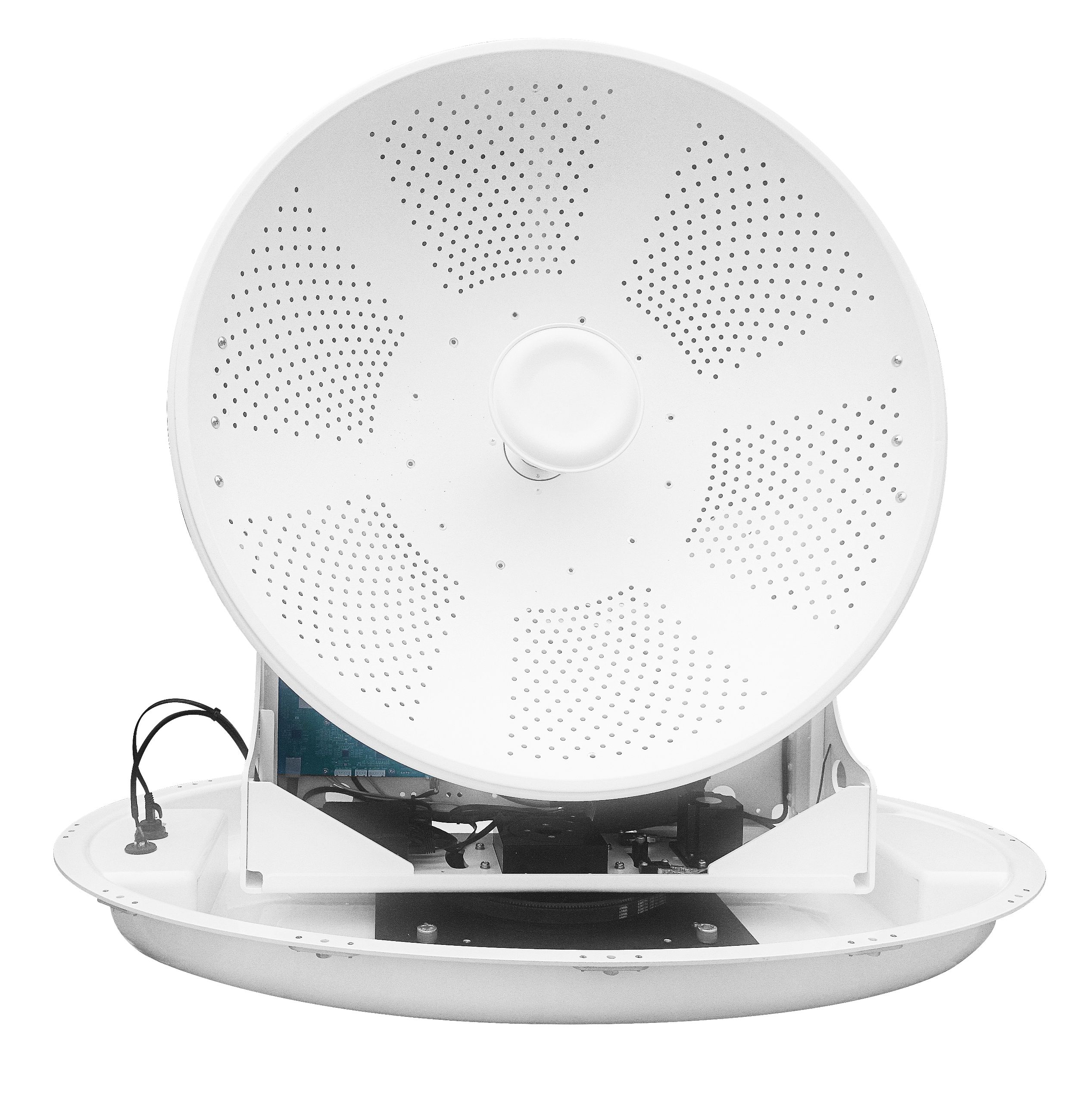
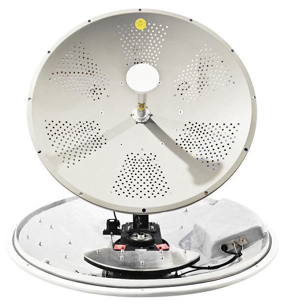
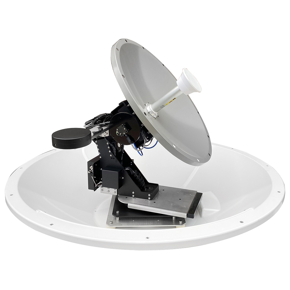
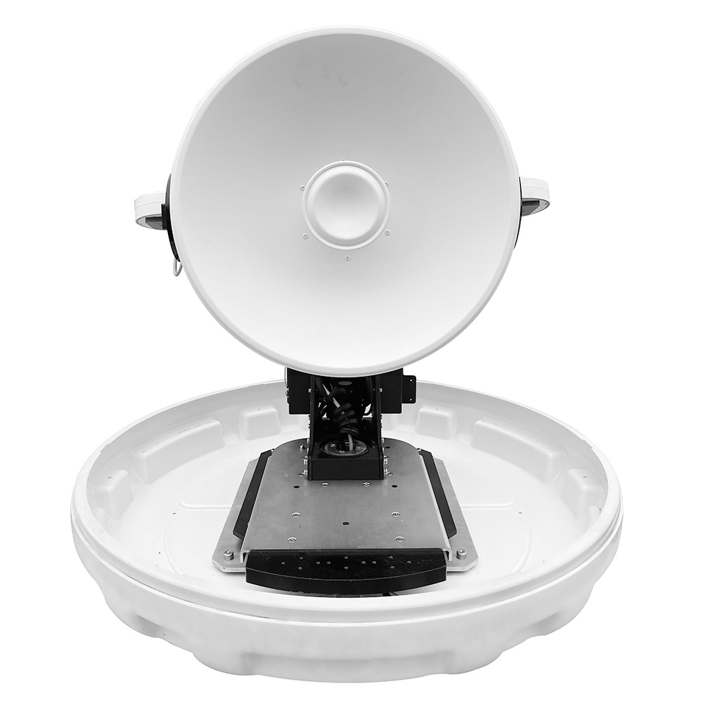
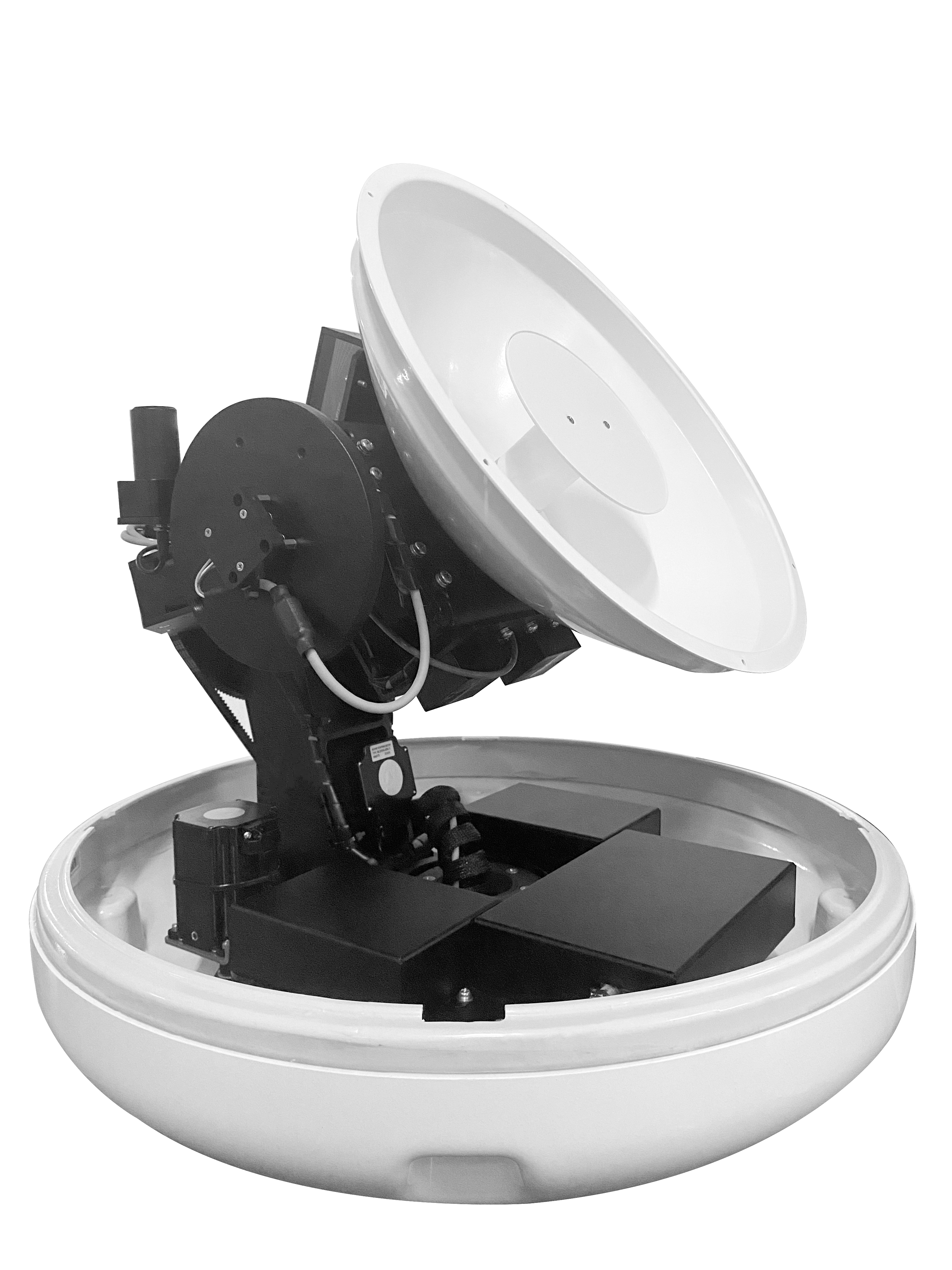
Tracking base station. KINGSAT ML4/M4L dual-axis microwave tracking antennas can be installed on emergency vehicles or elevated towers. Configurations with 36 cm/60 cm reflectors provide stated gains of 14–30 dBi and support automatic 360° azimuth tracking of maneuvering drones.
Command-and-control display. The received HD video is decoded and delivered to command displays in real time, supporting coordinated assessment and rapid return of operational instructions.
2.2 Core Technologies Behind the Solution
Field-Tested Long-Range Video Links: 33 km and 86 km
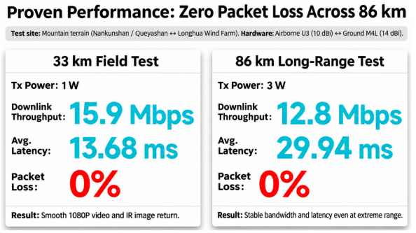
Dedicated 1.4 GHz long-range trials in mountainous areas produced the following measured results:
33 km field test — Nankun Mountain (800 m elevation) to Fengche Mountain, Longhua Town. The ground station used a KINGSAT M4L antenna (36 cm reflector, 14 dBi gain), paired with a U3 directional antenna (10 dBi gain) on the airborne side. At 1 W transmit power, measured downlink throughput reached 15.9 Mbps, with 0% packet loss and average latency of 13.68 ms. The link carried clear, smooth 1080p HD video.
86 km long-range test — Queya Mountain (1,100 m elevation) to Fengche Mountain. Using the same antenna combination at 3 W transmit power, the system achieved 12.8 Mbps measured downlink throughput, 0% packet loss, and 29.94 ms latency, demonstrating stable transmission over an extended distance under the test conditions.
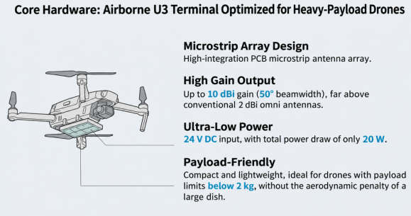
Lightweight U3 Airborne Tracking Antenna
Integrated microstrip array. The KINGSAT U3 uses a compact PCB microstrip antenna array with 10 dBi gain and a 50° beamwidth. It operates on 24 V DC and consumes only 20 W.
Designed for payload-sensitive aircraft. Its compact form factor makes it suitable for drone applications with limited available payload capacity, including platforms with payload allowances below 2 kg, and avoids the aerodynamic disadvantages of a large parabolic reflector.
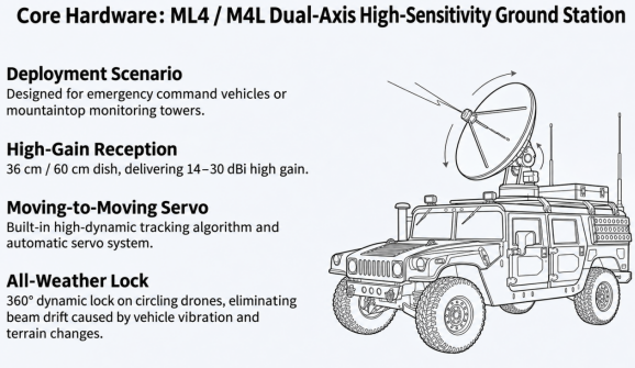
High-Sensitivity ML4/M4L Ground and Vehicle Tracking Stations
KINGSAT ML4/M4L dual-axis auto-tracking antennas can be deployed on emergency command vehicles or high-elevation monitoring towers.
Built-in dynamic tracking algorithms and servo control enable automatic 360° azimuth tracking of drones in flight, helping compensate for beam misalignment caused by vehicle movement, vibration, and changing terrain.
1.4 GHz Diffraction Performance and High-Power Mesh Networking
Support for the 1.4 GHz band offers relatively better diffraction around obstacles than higher-frequency microwave links, helping improve connectivity where trees, ridgelines, and valleys obstruct the path.
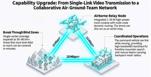
Integrated 1–20 W mesh networking modules support multi-node dynamic routing. The solution is intended to extend coverage along forest patrol routes and provide service access at 20 Mbps or above where link conditions and network design permit.
3. Benefits: Smarter Disaster Response and Border Monitoring
For forestry emergency teams and border patrol operators, the KINGSAT BVLOS video transmission solution offers three practical benefits:
3.1 Extend Aerial Visibility into Remote Areas
Combining the airborne U3 directional antenna with a high-gain M4L ground station supports long-distance aerial monitoring. The proposed single-sortie operational radius is 50–86 km or more, subject to flight endurance, airspace approval, and link conditions. Areas that could take ground teams days to reach may be surveyed from the air in a fraction of that time, supporting BVLOS patrol operations.
3.2 Low-Latency Video for Faster Situational Awareness
The cited tests recorded latency of 13.68–29.94 ms and 0% packet loss. Live 1080p zoom video and infrared thermal imagery can be transmitted back to the command vehicle, helping teams identify early-stage fire hotspots, abnormal temperatures, and potential border incursions promptly.
3.3 Rapid Mesh Networking for Coordinated Air–Ground Operations
A moving command vehicle can establish an air-to-ground link while a drone conducts surveillance or serves as an elevated relay node. This can provide high-bandwidth backhaul for search-and-rescue or patrol teams equipped with portable mesh radios, linking aerial platforms, ground vehicles, and field personnel into a coordinated communications network.
Conclusion
KINGSAT applies its experience in precision-stabilized microwave tracking, developed for demanding maritime environments, to low-altitude drone video transmission. Pairing the U3 airborne antenna with an M4L high-gain ground station helps address two persistent challenges in forested mountain terrain: maintaining connectivity around obstructions and keeping the link aligned while platforms are moving.
With automatic tracking and long-range wireless communications, KINGSAT helps emergency response and border monitoring teams build more capable BVLOS aerial observation and command networks.
Contact us: sales@kingsat-tech.com Official website: www.kingsat-tech.com
Youtube: http://www.youtube.com/@kingsatmaritimeantennas4640